IntraMaps is a dynamic application and as such provides its own set of tools. The IntraMaps application is displayed within a custom web browser which has the menu items and standard toolbars removed.
The IntraMaps screen consists of six main areas:
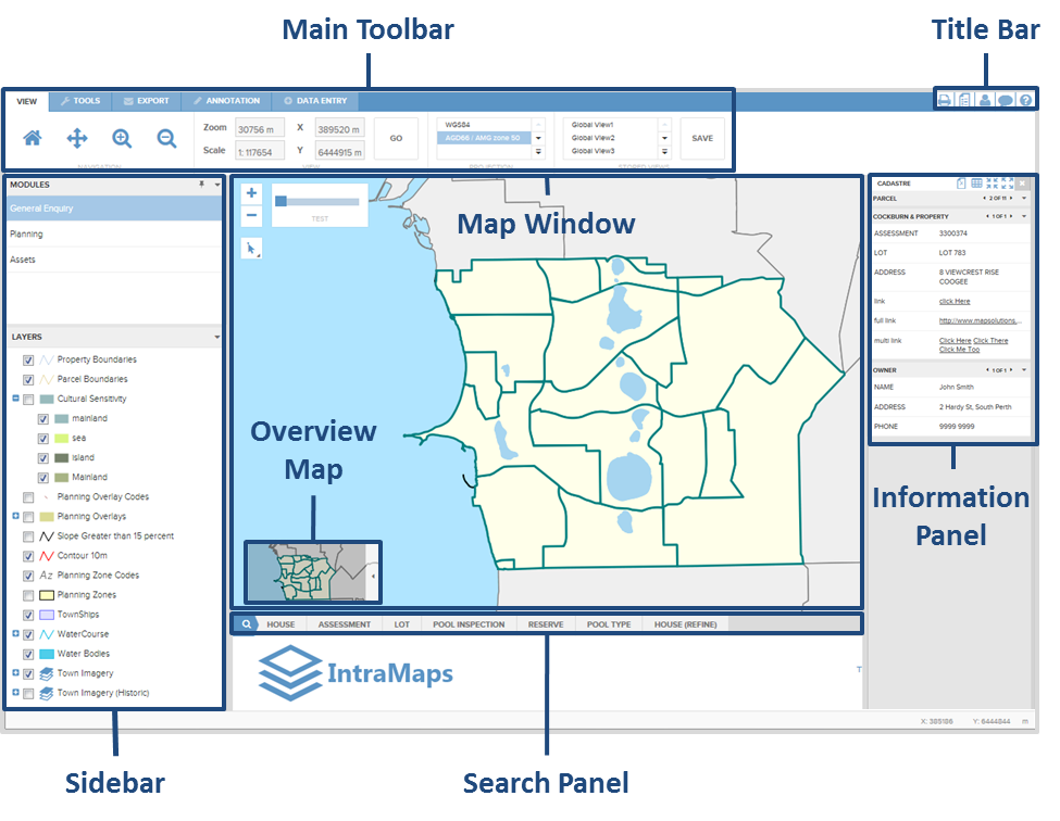
|
The Main Toolbar contains all the tools to make selections, control the view and navigate around the map. It also has tools that allow the user to carry out Mail Merge selections, add and save Annotations as well as Data Entry capabilities providing it's been set up by the GIS administrator.
The Map Window displays spatial data which is stored on a central server. The map display consists of one or more layers (groups of similar spatial data are often referred to as layers) and will often show both raster data (Photography) and vector data (Points, Lines & Polygons). To navigate within the map window use the navigation tools located above the map.
The Information Panel is located to the right of the Map Window. The Information Panel is dynamic and only appears when a Selection is made. The data displayed within the Information Panel is very flexible and may be from a variety of different databases, which are linked to the map layers in the map window.
The Search Panel appears below the map window and contains any search forms that have been configured by your system administrator. These search forms allow you to search for and select objects in the map window using different search criteria.
The Sidebar appears to the left of the Map Window and consists of three panels: Modules, Layers and Views. The Modules Tab has search forms and map layers specifically configured to a particular 'theme'. The Layers tab displays a list of layers available in the Map Window for the user to manipulate. The View Tab allows users to zoom to particular coordinates and scale, and save favourite views of the map to access quickly in the future.
The Overview Map appears to the bottom left of the Map Window and allows for a dynamic overall view tool.